Barras kuvia

Barras 1419 m
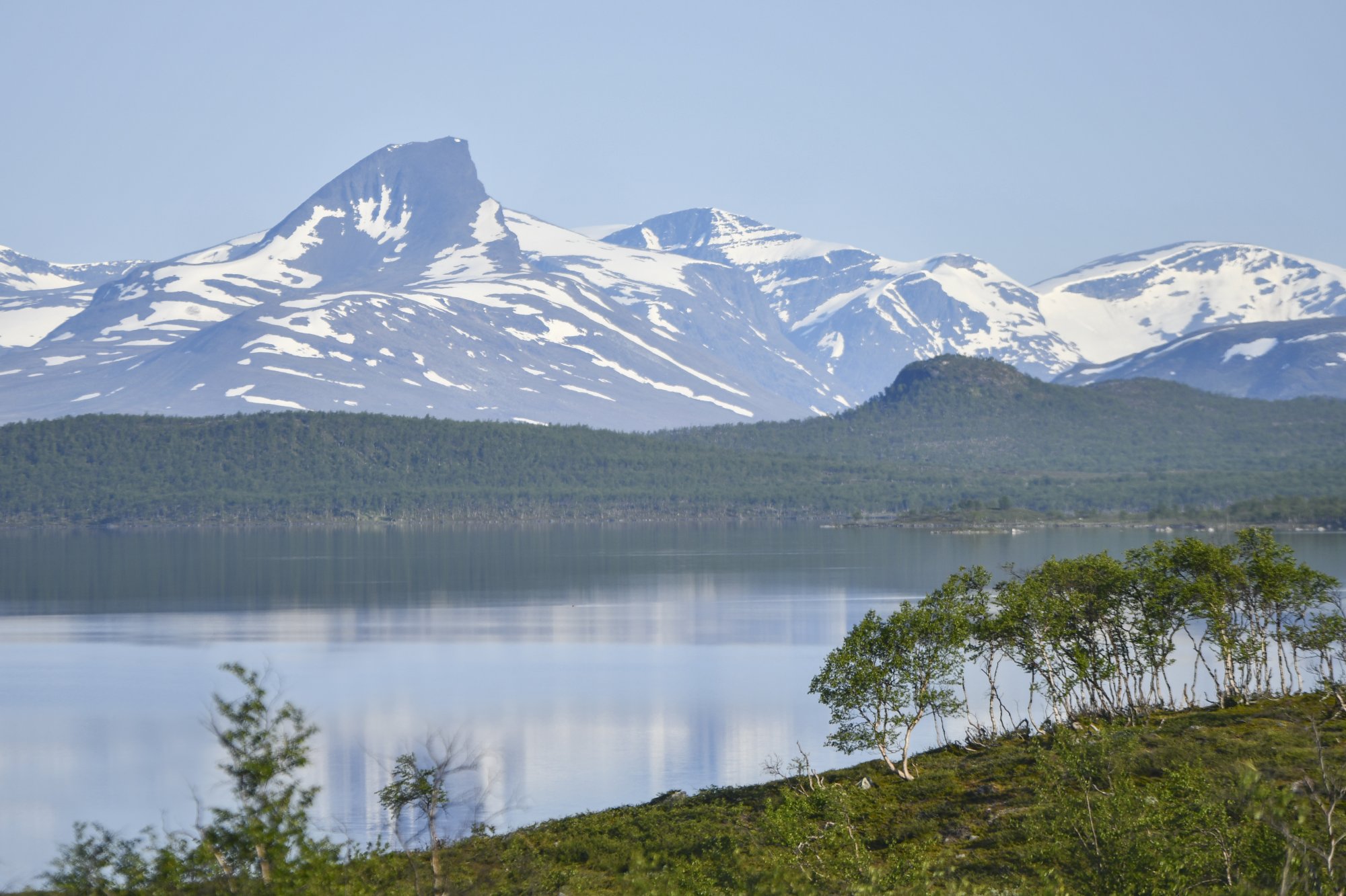
Barras (also known as Paras or Parastinden) is a 1,419-metre mountain rising on the Norwegian side near Kilpisjärvi, a familiar landmark for many who have visited the area. Reaching the summit rewards you with breathtaking views across lush mountain valleys and wilderness, and the route offers just the right level of challenge for a fit day hiker.
Route Starting Point
The hike to Barras begins on the Norwegian side in the village of Rognli, about a 1.5-hour drive (90 km) from Kilpisjärvi. Rognli is located in the Signaldalen valley, 20 kilometres from the village of Hatteng. At the trailhead, there is a parking area and a toilet. The first section follows a forest road for approximately three kilometres, after which the actual ascent begins on the marked trail leading toward Parastinden.
Route Character & Difficulty
The route to the summit begins gently, but the final kilometres consist of rocky slopes and a steeper ascent. Reaching the top requires a reasonable level of fitness, yet even less experienced hikers can complete the hike as a day trip in good weather conditions. In places, the trail may be poorly marked, so it is important to follow the route markers carefully. The total distance is approximately 16 kilometres from the parking area to the summit and back, with a total elevation gain of 1,350 metres. Read more about the route and the flow of a summit day in our hiking story Summit Day on Barras.
Useful tips
- Best time to hike: Summer and early autumn are the ideal seasons, but mountain weather can change rapidly even then. Be sure to check the forecast on Yr.no before setting out. Snow often lingers on the summit well into summer, but in most years the route becomes passable from July onward.
- Equipment: Good hiking boots and trekking poles will make the rocky sections easier to manage, especially on the descent.
- The trail is not always clearly defined, so despite the stunning scenery, it is important to stay alert and follow the route carefully.
- Water Sources:
The route follows streams and small rivers, so you can refill your drinking water along the way. You can also purchase Camelbak filtering bottles from us for safe and easy hydration on the trail. - Allow at least 7–9 hours for the summit hike, and be sure to factor in the driving time when planning your day.